The heat and drought of summer 2012 had farmers struggling to meet their harvest quotas, but the high precipitation levels and record low temperatures of spring 2013 are posing a new set of challenges. An article from Lawrence Journal World reported that while the conditions are helping to ease the effects of the drought, farmers are behind schedule with planting and growing, which threatens the success of their crops.
According to the National Weather Service, Kansas has seen temperatures below average for March and April and has had rain 12 out of 19 days, both of which are responsible for the stunted growth of plants that would typically be sprouting by now. Bruce Curtis, farmer of Fieldstone Farm and Orchard in Overbrook, KS, fears that late planting could prove detrimental to Kansas’ food production demands for 2013. However, the U.S. Drought Monitor has downgraded the drought condition from “severe” to “moderate” and predicts more rain in the forecast which will help raise the water level of lakes in the region.
Curtis told Lawrence Journal World that “[Farmers are] kind of stymied by the cold, and it’s definitely taking its toll. It’s probably the most unusual spring development we’ve seen, it promises to be challenging later in the year.” Although rain is what farmers were wishing for last year at this time, the onslaught of precipitation is creating another bout of crop production challenges: conditions too wet to plant and too cold for plants to grow.
As Kansas approaches the summer months, long-term forecasts from the U.S. Drought Monitor suggest the possibility of more rain for May and June, which could increase the farmers’ struggle to make up the time lost in springtime planting and growing.
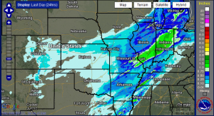
Photo courtesy of the National Weather Service